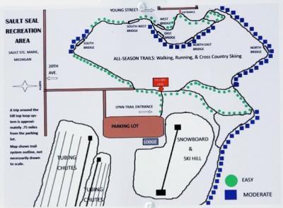
The Lynn Trail System at the Sault Area Recreation Area is a great place for a hike.
It doesn’t get much more convenient than having a cross-country and snowshoe trail right in the city limits! The Lynn Trail System is located in the Sault Seal Recreation Area, about two minutes from downtown Soo.
Lynn Trails are located at Sault Seal Recreation Area on the other side of the parking lot from the tubing hill. They include boardwalk, bridges, pavilion observation facility and pond. Maps are available indicating named trail sections. “Soccer Field Trail” is .2 miles. “Ski Hill Trail” is .25 miles. “East Trail” is .3 miles. “West Trail” is .25 miles. “East Trail” is .3 miles. “North Trail” is .2 miles. “Valley Trail” is .2 miles. “Ridge Trail” is .1 miles. “Science Park Walk” is .2 miles. The trails are connected and loop back to the starting point. The adjacent Natural Science Park exhibits rocks with fossils, gold, copper and more.
Directions
2601 MInneapolis St.
Sault Ste. Marie, MI 49783
United States